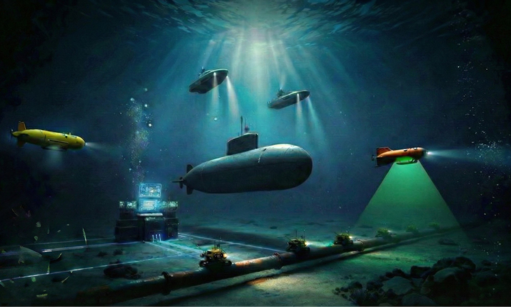
Strategic Pings: The Five Levels of SideScan Sonar

Executive Summary

Sidescan sonar is one of the most misunderstood tools in maritime autonomy. Too many people treat it as a simple imaging sensor. It is not. It is a mission capability, and the level of that capability depends on the acoustic architecture, platform integration, survey speed, navigation quality, processing chain, and classification requirement.

Sidescan is like wine, if you ever try a high-quality wine, you can never go back…

A basic sidescan sonar can show you that something is on the seabed. A high-end synthetic aperture sonar can help you understand what that object may be, with enough fidelity to support serious operational decisions. That difference matters. Especially in mine countermeasures, route survey, seabed infrastructure inspection, and autonomous underwater vehicle operations.

Here is the uncomfortable truth: buying an AUV and adding a sonar does not create a mine-hunting system. It creates a vehicle with a payload. The mission starts when the payload can deliver the information needed at the speed, resolution, and confidence level required.

So let’s walk through five practical levels of side-scan sonar capability.

Level 1: Basic SingleBeam SideScan Sonar

This is the starting point. Think basic Marine Sonic-type side-scan sonar. Simple, effective, proven, and often very useful.

At this level, the sonar gives you acoustic imagery of the seabed. You can see wrecks, debris, cables, pipelines, rocks, tires, anchors, and sometimes objects that make your mine warfare people sit up a little straighter.

Marine Sonic Sidescan Image (Copyright Marine Sonic website)

This level is excellent for search and recovery, basic survey, training, first responder work, port inspection, and general seabed familiarization. It teaches operators the fundamentals: shadows matter, altitude matters, stability matters, and bad sonar geometry creates bad interpretation.

But Level 1 has limits. The image may look fine, but beauty is not classification. A long shadow may indicate height. A bright highlight may indicate hardness. But you still need experience, context, navigation, and often another look. This is where many organizations fool themselves. They see an object on the seabed and say, “We detected it.” Fine. But detection is cheap. Understanding is expensive.

Level 2: AUV-Integrated SingleBeam SideScan Sonar

Level 2 moves the sonar from a simple towed or basic configuration into the AUV world. Think EdgeTech and Klein 3500-class systems integrated into autonomous underwater vehicles. The sonar images are much crisper and detailed compared to level 1.

Now the conversation changes.

The sonar is no longer just making pretty pictures behind a boat. It is part of an autonomous mission system. The vehicle must maintain altitude. It must hold a stable track. It must navigate accurately. It must collect data in a repeatable pattern. It must bring the sensor through the water in a controlled way.

This is a big step.

KLEIN 3500 (Copyright KLEIN)

AUV-mounted sidescan sonar can reduce surface vessel dependency and improve access to areas where towing is difficult. It also keeps the sonar closer to the seabed, which can improve image quality and consistency in deeper water.

But there is a catch. The sonar is now fully dependent on the platform. Poor vehicle stability, bad altitude control, weak navigation, or poor mission planning will degrade the data. The AUV may look impressive in the brochure, but the seabed image will tell the truth.

At Level 2, the vehicle and sensor become one system. If they are not designed together, the mission suffers.

Level 3: MultiBeam SideScan Sonar for Higher-Speed Survey

Level 3 is where things become very interesting. This is the level of systems like Klein MANTIS UUV, using a more advanced multi-beam side-scan approach to deliver high-resolution imagery with improved area coverage.

The operational value is simple: better imagery at higher survey speed.

That matters because offshore operations are not academic exercises. Time offshore costs money. Time in a minefield costs risk. Time spent reacquiring targets costs patience, endurance, and sometimes political capital.

A traditional sidescan sonar often forces a trade between resolution and speed. Go too fast and image quality suffers. Push the range too far and classification confidence drops. Try to cover too much area and you may pay for it later with re-runs.

KLEIN Multibeam 5900 multibeam sidescan technology - Similar to the new MANTIS (Copyright KLEIN)
KLEIN Multibeam 5900 multibeam sidescan technology – Similar to the new MANTIS (Copyright KLEIN)

Multibeam sidescan changes that equation. It gives the operator more usable information across the swath and supports faster, more efficient surveys. For AUVs and UUVs, this is critical. Battery life, endurance, data volume, and mission time are always in negotiation.

Level 3 does not magically solve classification. But it raises the quality of the first look. And in real operations, the quality of the first look often determines how expensive the second look becomes.

Level 4: Entry-Level Synthetic Aperture Sonar

Level 4 is the start of synthetic aperture sonar. The Kraken SAS is a strong general-purpose example. Good value for money if you want to have a SAS sonar.

SAS is not just a better side-scan sonar. It is a different way of thinking about acoustic imaging. Instead of relying only on the physical aperture of the sonar array, SAS uses vehicle motion and coherent processing to synthesize a much larger aperture.

The result is high resolution over longer range, with more consistent image quality across the swath.

This is where sidescan starts moving from “I see something” toward “I can make a much better judgment about what I am looking at.”

KRAKEN SAS (Copyright Kraken)

For mine countermeasures, this matters. For seabed infrastructure inspection, this matters. For route survey, this matters. For any mission where the decision is more important than the picture, this matters.

But SAS is not free. It demands stable platform motion, good navigation, careful integration, serious processing, and disciplined survey design. Put SAS on a poor platform and you will discover that physics has a sense of humor.

Level 4 is a major capability step, but it requires respect.

Level 5: Multi-View Synthetic Aperture Sonar

Level 5 is where the game becomes operationally serious. This is where systems such as Thales SAMDIS 600 come in, using multi-view or multi-aspect synthetic aperture sonar to improve classification of mine-like objects in a single pass.

This is a big deal.

Traditional sonar imagery often gives you one dominant view of an object. But mine-like objects can be deceptive. A cylinder, rock, tire, cable crossing, biological feature, or piece of debris may look suspicious from one angle and harmless from another. Aspect matters.

Multi-view SAS attacks this problem directly. By providing multiple views or aspects in one pass, it gives the operator and the automatic target recognition chain more information about object shape, shadow structure, seabed interaction, and acoustic response.

THALES SAMDIS 600 (copyright THALES)

In plain English: it reduces guessing.

That does not mean it removes the human from the loop. It means the human gets better information. It means the ATR has better features to work with. It means one pass can carry more classification value than a conventional survey line.

I call this the “Probability of Correct Classification”; and with a single pass, a skilled operator or ATR has about 35%-50% correct classification. With multiview, that goes up to 90%, which is a significant improvement.

For mine countermeasures, this is the direction of travel. The future is not just detection. The future is confident classification, reduced reacquisition, fewer unnecessary interventions, and faster decisions.

The Real Lesson

The five levels are not about brand names. They are about mission maturity.

Level 1 helps you see the seabed. Level 2 puts that capability on an autonomous platform. Level 3 improves coverage and speed. Level 4 brings synthetic aperture resolution. Level 5 adds multi-view classification power.

Each level costs more. Each level demands more from the platform, the operator, and the data chain. But each level also moves you closer to the real objective: useful information.

And that is where the industry needs to be more honest.

An autonomous underwater vehicle is not a mine-hunting system because someone bolted a sonar to it. A USV is not an MCM system because it can tow something. A beautiful waterfall display is not a classification decision.

The mission defines the sensor. The sensor defines the platform requirements. The platform only has value when it helps deliver the mission.

That is the part too many autonomy presentations skip.

Call to Action

If you are buying, building, or integrating autonomous systems for survey, MCM, or seabed security, ask one question before anything else:

What level of information do we need to make the decision?

Not what vehicle looks best. Not what payload fits easiest. Not what gives the nicest demo image.

Start with the decision. Then work backward to the sonar, the platform, the navigation, the processing, and the operating concept.

Because in underwater operations, the expensive mistake is not missing the target.

The expensive mistake is thinking you understood it.

Please comment so we can all learn from each other.

/Thomas


Originally published in the Strategic Pings ))) newsletter on LinkedIn on 2026-06-23. Subscribe there to get new editions first.

The New Acoustic Frontier: USVs Are Changing the Economics of Geophysical Survey

Executive Summary

Offshore geophysical survey is entering a new phase. The serious shift is no longer about proving that uncrewed surface vessels can operate offshore. That argument is already aging badly. The real question is now operational: can we scale ocean data acquisition with smaller crews, lower emissions, better repeatability, and higher data density?

High-endurance USVs are starting to answer that question. By moving people off the vessel and keeping the sensor package at sea, operators can reduce risk, cut cost, improve consistency, and collect more data with a much smaller offshore footprint. But here is the uncomfortable part: a USV without the right sensor payload, positioning system, towing architecture, and launch and recovery capability is just an expensive remote-controlled boat. The value is not the hull. The value is the acoustic data, correctly positioned, correctly acquired, and delivered fast enough to support real decisions.

Welcome to the new Acoustic Frontier

For decades, offshore geophysical survey has been built around large crewed vessels, heavy logistics, offshore rotations, and a lot of fuel burned to move humans and sensors across the ocean. That model worked, but it was never elegant. It was expensive, carbon-heavy, and increasingly dependent on a limited pool of experienced offshore personnel.

High-endurance USVs are changing that equation.

Platforms such as XOCEAN, DriX, C-Worker, and other modern survey USVs are now being used as serious data acquisition platforms. They can stay offshore for days or weeks, operate with remote supervision, and carry integrated sensor suites for bathymetry, seabed mapping, shallow geology, and asset inspection.

High Performance USVs

This is where autonomy becomes interesting. Not because the boat is unmanned. That is the least interesting part. It becomes interesting because the acquisition process becomes more repeatable. A well-designed USV can hold survey lines with machine-like discipline, maintain consistent speed, reduce human fatigue, and support remote operations from shore-based control centers.

That matters. In survey, consistency is not a luxury. It is data quality.

The foundation of the stack is still familiar to any hydrographer or geophysicist. Multibeam echosounders map the seabed. Sub-bottom profilers look below it. GNSS and inertial navigation systems position every ping. The physics has not changed. The delivery model has.

A modern USV is essentially a compact geophysical laboratory. With a properly integrated multibeam echosounder (MBES), sub-bottom profiler (SBP), sound velocity sensors, GNSS, INS, and telemetry, the platform can produce a high-quality digital picture of the seabed. But that digital twin is only as good as the navigation behind it. Poor positioning turns good acoustic data into expensive noise with pretty colors.

This is where some of the market hype needs a cold shower.

The USV is not the capability. The USV enables the capability.

If the platform cannot carry the right sensors, protect them from flow noise and vibration, maintain stable survey geometry, and support accurate positioning, it will not deliver the mission. Range and endurance look good in brochures, but payload integration wins offshore.

The same logic applies when we move from broad seabed mapping to high-resolution inspection. For UXO surveys, cable routes, and detailed seabed feature detection, hull-mounted sensors are often not enough. The sensor must get closer to the seabed. Sometimes it must fly at a controlled altitude only a few meters above bottom.

That is the proximity problem.

Launch And Recovery Systems

Towed systems and remotely operated towed vehicles solve it. Active towed platforms such as FlipiX, ViperFish, and similar systems are no longer simple towfish dragged behind a vessel. They are controlled acoustic platforms with steering, altitude control, pitch and roll management, and automation that keeps the sensor where it needs to be.

FlipiX (EXAIL)
FlipiX (EXAIL)

This is critical for sidescan sonar, magnetometers, and high-resolution geophysical payloads. A stable sensor at the right altitude will beat a more expensive sensor flown badly. Survey quality is often lost in geometry, motion, and handling, not in the sonar brochure.

That brings us to the less glamorous part of autonomy: launch and recovery.

Everyone likes to talk about AI, remote operations, and endurance. Fewer people want to talk about winches, cable tension, heave compensation, snag recovery, layback management, and wet-end engineering. Yet this is where offshore autonomy either becomes operational or stays trapped in the demo phase.

A USV that tows a sensor needs an integrated handling system. The winch must communicate with the vessel autopilot. The platform must manage cable geometry, turning radius, tension, speed, and seabed clearance. Active heave compensation can extend the operational window during launch and recovery. Automated emergency hauling can protect the payload if the system detects a snag or overload.

Launch And Recovery Systems (LARS)

This is not a minor detail. This is the difference between a controlled survey operation and an expensive fishing trip.

The human role is also changing. Remote operation centers do not remove expertise. They reposition it. Senior surveyors, data processors, mariners, and payload specialists can support multiple operations from shore. A distributed fleet can be managed by a smaller, more specialized team. That improves safety, reduces offshore exposure, and makes the work more attractive to people who do not want a career built around long rotations and night shifts.

The offshore industry is often conservative for good reasons. Saltwater punishes weak ideas. Weather exposes lazy engineering. Bad data has real cost. But the direction is clear.

High-endurance USVs are no longer toys looking for missions. In geophysical survey, they are becoming force multipliers for serious ocean data acquisition.

The winners will not be the companies with the flashiest unmanned hull. The winners will be the teams that understand the full stack: platform, payload, positioning, towing, launch and recovery, data quality, and remote operations.

Because in the end, nobody pays for autonomy.

They pay for trusted seabed intelligence.

Call-To-Action

please comment and give me your opinions, so we all can learn from each other.


Originally published in the Strategic Pings ))) newsletter on LinkedIn on 2026-06-16. Subscribe there to get new editions first.

Strategic Pings: The Future of Subsea Intelligence Will Not Be Crewed

Executive Summary

Commercial USVs are no longer experimental toys looking for a mission. They are becoming serious survey, inspection, ISR, and subsea intelligence platforms. The shift is not driven by fashion. It is driven by safety, cost, endurance, sustainability, and better acoustic data.

The uncomfortable truth is simple: many crewed workboats used for hydrographic and subsea survey were never designed as precision acoustic platforms. They were adapted. Sometimes well. Often expensively. USVs, by contrast, are increasingly designed around the sensor, the mission, and the data pipeline. (Some are, of course, not; that’s what I call “Paddleboard” manufacturers.

The future of offshore survey will not be decided by who owns the biggest vessel. It will be decided by who can collect cleaner data, process it faster, operate longer, reduce risk, and scale autonomous fleets. The workboat is not dead. But its monopoly is over.

Why Commercial USVs Are Forcing a Hard Reset in Subsea Intelligence

For decades, the maritime industry has been strangely comfortable with a bad habit: taking crewed vessels built for people, fuel, deck space, and endurance, then trying to turn them into precision acoustic instruments.

That worked because there was no better option. Now there is.

The commercial USV invasion is not about replacing every vessel with a robot. That is the lazy version of the story. The real story is sharper: USVs are forcing the industry to admit that the platform should serve the sensor, not the other way around.

A sonar does not care how expensive your workboat is. It cares about stability, alignment, water flow, acoustic noise, motion compensation, timing, sound velocity, and clean data. The ocean is already noisy enough. We do not need the vessel adding more chaos.

Why USVs Are Winning Attention

The commercial USV argument rests on four practical pillars.

4 Pillars of USV Operations

First: safety. Moving people off exposed decks and into remote operations centers is not a marketing slogan. It reduces risk. Offshore survey, inspection, and security work still involve weather, fatigue, deck operations, launch and recovery, and transit exposure. Removing people from the danger zone is a real operational gain.

Second: cost. Crewed vessels carry people, fuel, accommodation, safety systems, galley capacity, and all the overhead required to keep humans alive offshore. A USV does not need coffee, bunks, or a crew change helicopter.

Third: sustainability. Electric and hybrid USVs are not perfect, but they cut fuel burn for many mission profiles. In ports, rivers, reservoirs, nearshore survey, and persistent monitoring, smaller autonomous platforms can do useful work with a much lighter footprint.

Fourth: data quality. This is where sonar people should pay attention. A well-designed USV can place the sensor in a cleaner acoustic environment. Catamarans can give stable payload geometry. Moonpools, gondolas, and dedicated sensor wells can reduce bubble sweep and flow noise. That matters. Bad acoustic installation can turn a great sonar into an expensive noise generator.

Catamaran, Monohull, or Something Else?

USV design is not cosmetic. Hull form shapes mission performance.

Small catamarans, such as shallow-water hydrographic USVs, offer stability, payload access, and simple deployment. They are practical for reservoirs, ports, rivers, coastal construction, and nearshore surveys. They are not glamorous. They are useful. Examples are SeaFloor Echoboat and EvoLogic SonoBot. Small and well designed.

Larger monohull USVs, such as offshore survey designs, focus on speed, endurance, seakeeping, and clean survey lines. These are built for more serious offshore work, including deep-water mapping, energy infrastructure, and long-duration operations.

Special mention is the EXAIL Drix, the most “sexy” USV on the market, looks like a racing sailing boat, which you understand when you meet the designer, who used to design racing sailing boats. It is also one of the most capable USV on the market.

Multiple USVs of different styles

Then you have long-endurance platforms built for persistence. These are not just survey tools. They start to look like maritime sensing nodes. With sonar, radar, EO/IR, AIS, passive acoustic sensors, satellite communications, and autonomy, the USV becomes part of a distributed maritime intelligence network.

CHANCE MC40-R - Long Range USV
CHANCE MC40-R – Long Range USV

Special mention about the Chance MC40-R USV Long range – latest survey was 38 days and 4000 nm.

That is the bigger strategic shift. The USV is not just a small boat without a crew. It is a mobile sensor node.

The Sonar Question: What Are You Actually Measuring?

Being a sonar nerd, this is where the conversation gets more serious.

Hydrographic survey is not about making pretty seabed pictures. It is about uncertainty, coverage, repeatability, and confidence. The sonar payload matters more than the platform brochure.

For shallow-water work, a compact multibeam echosounder may be enough. For infrastructure inspection, quay walls, pipelines, cables, and small-object detection, you need better geometry, higher frequency, better motion compensation, and tighter integration.

Interferometric systems and side scan sonars are powerful tools, especially for coverage and imagery. But they are not the same as a true multibeam echosounder. A multibeam system gives direct bathymetric measurement across the swath. It handles nadir better and gives stronger performance for vertical structures when properly installed and calibrated.

Multibeam Echoslunders (EM2042, SeaBat T50, Norbit Winghead)

That distinction matters. If you are inspecting a quay wall, searching for debris near a cable, or trying to detect a small object in a harbor, the sonar selection is not a detail. It is the mission.

Frequency also matters. Lower frequencies support range and penetration. Higher frequencies deliver sharper resolution but lose range faster. There is no magic frequency. There is only the right trade-off for depth, range, bottom type, target size, speed, and required confidence.

The Payload Is the Capability

Here is the line the industry needs to remember:

A USV is not the capability. A USV enables the capability.

The capability is the payload, integration, autonomy, communications, navigation, processing, and workflow. A small USV with a well-integrated sonar package can outperform a larger vessel with a poor installation. A large USV with weak data handling is still just an expensive remote-controlled boat.

This is why the next competition will not be only about hulls. It will be about sensor fusion and autonomous data processing.

Can the USV detect a target or object on the seafloor?

Can it classify it?

Can it compare it against previous survey data?

Can it alert an operator in near real time?

Can it send the right evidence, not just more data?

That last point is critical. Offshore operations already generate too much data. The winning autonomous platform will not be the one that records the most. It will be the one that helps the operator understand the fastest.

Detection is cheap. Understanding is expensive.

The Provocation: What Is the Workboat Still Doing?

Crewed workboats will not disappear. They remain essential for heavy payloads, complex offshore work, maintenance, repair, construction, and missions where humans must be on scene.

But the default assumption is changing.

If the mission is repetitive, dull, dangerous, persistent, data-heavy, or sensor-driven, the USV deserves a serious look. If the platform can run longer, collect cleaner data, reduce risk, and push processed intelligence back to shore faster, then tradition is not a strategy. It is just expensive nostalgia.

The commercial USV invasion is already underway. The question is no longer whether autonomous platforms can work.

The better question is this:

If a USV can survey the seabed, inspect the asset, classify the target, and deliver the evidence without putting people offshore, what exactly are you defending by keeping the old model?

The future belongs to operators who manage fleets of intelligence, not just vessels.

And in that future, the smartest boat may be the one nobody is standing on.


Originally published in the Strategic Pings ))) newsletter on LinkedIn on 2026-06-10. Subscribe there to get new editions first.

Undersea Awareness Is the New High Ground: Insights from MINWARA 2026

MINWARA 2026 really underlined that mine warfare is shifting from platform-centric “minehunters” to networked, data‑driven undersea awareness built on autonomy, AI, and better integration across the whole stack.

Photo collage of vendors

From minehunting to undersea awareness

The 2026 theme in San Diego centered on “Enhanced Undersea Awareness: Achieving Tactical Dominance in Mine Warfare,” explicitly broadening the conversation beyond traditional MCM into the wider undersea kill chain. This framing puts equal weight on sensing, data fusion, and decision support as on the physical act of hunting and neutralizing mines.

Autonomy is now assumed, not aspirational

USVs and AUVs are no longer side notes; they are the default architecture for future MCM concepts of operations, with industry and government using the symposium as a venue to showcase unmanned solutions. Discussions and exhibits emphasized reliability of the entire autonomy stack (comms, collision avoidance, power, and onboard processing) as a prerequisite for real operational adoption.

Sonar is no longer the only sensor in town

Sonar and synthetic sidescan are no longer the only stars of the show because modern MCM problems demand more than just acoustic imagery. As adversaries experiment with low‑metal, low‑acoustic‑contrast mines and complex seabed environments, navies need additional phenomenology to close the detection and classification gaps. Magnetometers bring sensitivity to tiny magnetic anomalies that acoustics can miss, while electric‑field sensors exploit the subtle disturbances created by man‑made objects and platforms in the water. Together with sonar, they form a multi‑domain sensor suite that is more resilient to deception, more robust across environments, and far better at turning “maybe” contacts into confident, actionable decisions.

Data, AI, and operational integration

A recurring thread across sessions and exhibitors was operational data management: how to ingest, govern, and exploit sensor data at scale so AI/ML (ATR) can actually deliver trusted target recognition and decision support. The mine warfare community is clearly aligning with broader defense trends around “trusted AI,” rugged edge compute, and consistent software stacks from data center to forward nodes.

Ecosystem and collaboration

MINWARA continues to position itself as the cross‑domain hub where Navy, industry, and academia converge to align technology roadmaps with real MCM and undersea warfare problems. The 2026 event reinforced that solving mine warfare is less about a single “silver bullet” platform and more about tighter integration between sensors, autonomy, C2, and operators across services and nations.

Final thoughts

This is a very well-organized conference, and I want to thank the ladies and the people who organize it every year. Special thanks to Mark Rios for his MCM Trivia.


Originally published in the Strategic Pings ))) newsletter on LinkedIn on 2026-06-04. Subscribe there to get new editions first.

Strategic Pings: The Mosquito Fleet That Sank an Empire’s Ego

Executive Summary

Ukraine has changed the naval conversation in the Black Sea. A country with almost no traditional navy has forced one of the world’s major fleets to pull back, disperse, hide, and rethink how it survives at sea.

The real lesson is not that unmanned surface vessels are clever. The lesson is that cheap, fast, expendable maritime systems can compress the kill chain faster than legacy navies can adapt. A small unmanned boat with a warhead, a camera, onboard autonomy, and enough range can now threaten ships that cost hundreds of millions of dollars.

This is a warning shot for every navy still measuring power mainly in tonnage, hull count, and exquisite platforms. Ukraine’s USV campaign shows what happens when innovation cycles move in months while procurement cycles move in decades.

For sonar, autonomy, and maritime systems professionals, the Black Sea is not just a war story. It is a live laboratory. Navigation under jamming, last-mile autonomy, passive and active sensing, modular payloads, drone-carrier USVs, and semi-submersible systems are all becoming part of the new naval toolkit.

The uncomfortable question is simple: are we building fleets to fight the next war, or are we building bigger targets?

The Black Sea Wake-Up Call

Navies love hierarchy. Frigates screen destroyers. Destroyers protect carriers. Submarines hunt in silence. Amphibious ships wait for the beach. Everything has a role, a doctrine, and a procurement file thick enough to stop small-arms fire.

Then Ukraine arrived with what looked like explosive jet skis.

The result has been strategically brutal. Ukraine has used unmanned surface vessels, missiles, intelligence, and rapid iteration to push the Russian Black Sea Fleet away from parts of its own operating area. This is not a minor tactical nuisance. This is sea denial created by a nation without a blue-water navy.

That should make every admiral sleep badly.

Russian Moskva sunk by Ukranian USV

The classic naval assumption was that expensive ships created control. Ukraine has shown that persistent, expendable, networked systems can deny control at a fraction of the cost. A $100,000 to $250,000 unmanned attack craft does not need to “win” against a $500 million warship in a fair fight. It only needs to find it, reach it, and damage it badly enough to change behavior.

That is the new math of maritime warfare.

From Suicide Boat to Modular Naval System

The first Ukrainian USVs were often described as “suicide boats.” That description is technically useful but strategically too small.

These systems are evolving from one-way explosive craft into modular maritime platforms. The Magura family brought speed, range, and a meaningful payload. Sea Baby added larger warheads and modular strike options. Newer systems such as Katran-type craft point toward faster, more flexible, multi-role configurations.

The direction is clear. The USV is no longer just a floating bomb. It is becoming a maritime truck for payloads.

That payload can be explosive. It can be sensors. It can be rockets. It can be loitering munitions. It can be a small aerial drone launched from the sea. It can even be air-defense missiles carried on a surface drone.

That is where this gets interesting and uncomfortable.

A traditional ship is designed around mission sets. A modular USV can be configured around the target. One week it attacks a ship. The next week it scouts a coastline. Then it carries FPV drones against air-defense radars. Then it acts as a decoy. Then it becomes a hunter.

The platform becomes less important than the payload, the software, and the kill chain.

That should sound familiar to anyone working with sonar, autonomy, hydrography, mine countermeasures, or ISR. The vehicle enables the capability. It is not the capability by itself.

Autonomy Is Now Survival, Not Marketing

The Black Sea has also exposed a hard truth about remote control. If the enemy can jam you, spoof you, or cut your data link, then a purely remote-controlled system becomes fragile.

That is why last-mile autonomy matters.

When a USV closes on a defended target, the electronic environment becomes ugly. GNSS can be jammed. Communications can be degraded. The operator may lose the video feed. The platform still has to navigate, avoid obstacles, recognize the target area, and complete the mission.

That requires onboard processing. It requires sensor fusion. It requires visual navigation, inertial systems, radar or optical cues, and enough autonomy to keep going when the link gets thin.

This is not science fiction. This is practical survival engineering.

For maritime autonomy, the lesson is direct: the communication link is no longer the brain. The link is guidance. The brain must increasingly live onboard the platform.

This has major implications for all unmanned maritime systems, including USVs, UUVs, AUVs, and hybrid semi-submersibles. In contested waters, autonomy is not a luxury feature. It is the difference between a weapon that fails when jammed and a weapon that keeps hunting.

The Sonar and Sensing Angle

Surface drones get most of the attention because the videos are dramatic. But the next layer is underwater.

Semi-submersible and underwater systems shift the problem from visible surface defense to detection, classification, and tracking below the surface. This brings sonar back into the center of the story.

A semi-submerged vehicle can reduce radar exposure. An underwater vehicle can loiter, listen, and approach from below. Passive sonar can detect machinery signatures. Active sonar can support final localization. Inertial and acoustic navigation can help when GNSS is unavailable.

Sonar on Autonomous Platforms

That creates a very different defensive problem.

Ships are built to defend against missiles, aircraft, torpedoes, and mines. They are less comfortable when small, cheap, semi-autonomous systems blur those categories. Is it a mine? A torpedo? A drone? A decoy? A sensor? A weapon carrier?

Toloka AUV
Toloka AUV

The answer may be yes.

That ambiguity is part of the power.

The Drone Carrier at Sea

One of the most provocative developments is the maritime mother-drone concept.

A USV can carry aerial drones close to a coastline, launch them from unexpected angles, and attack sensors, radars, vehicles, or air-defense systems behind the front line. This breaks the normal geography of attack.

The coastline becomes a launch corridor. The sea becomes a hidden runway. The USV becomes a small carrier.

For defenders, this means the maritime threat no longer ends at the waterline. A surface drone may be carrying another drone. A boat may be a launcher. A launcher may be a decoy. A decoy may be mapping defenses for the next strike.

This is where cheap systems become expensive problems.

The Big Navy Problem

Large navies should not dismiss this as a Ukraine-only story. The Black Sea is a warning, not an exception.

Big ships still matter. Submarines still matter. Air defense still matters. Logistics still matter. But the balance is changing. Expensive platforms now need to defend themselves against mass, speed, deception, autonomy, and low-cost saturation.

That creates a brutal procurement question.

Can a navy afford to defend every high-value ship against swarms of cheap autonomous systems? Can it reload fast enough? Can it detect small surface contacts in clutter? Can it classify them early enough? Can it fight when GNSS is denied and data links are jammed?

The uncomfortable answer is that many fleets are not ready.

They are built around exquisite capability, not fast adaptation. Ukraine is proving that iteration speed can become a weapon. Three-month learning cycles are beating thirty-year acquisition habits.

Final Ping

The Black Sea has delivered a message in saltwater and steel.

The future navy will still need powerful ships, submarines, aircraft, and trained crews. But it will also need cheap mass, modular payloads, autonomous navigation, resilient sensing, and the humility to learn from smaller players moving faster.

The mosquito fleet is not a replacement for the navy.


Originally published in the Strategic Pings ))) newsletter on LinkedIn on 2026-06-01. Subscribe there to get new editions first.

Strategic Pings: The Big Silent Hunters

Executive Summary

Extra-Large Uncrewed Underwater Vehicles, or XLUUVs, are changing
undersea warfare. Not because they are big. Not because they are
unmanned. And not because they look impressive in defense exhibition
renderings.

They matter because they can carry mission payloads into places where
humans should not have to go, stay there for a long time, and collect
acoustic intelligence in a GPS-denied, radio-silent, pressure-heavy
environment.

But here is the uncomfortable truth.

An XLUUV without the right sonar payload is just an expensive
underwater bus.

The platform provides endurance. The payload provides purpose. The
sonar provides understanding.

Why
XLUUVs Are Not Underwater Trucks, They Are Sensor Weapons

For more than a century, the submarine was the apex predator of the
undersea domain. Silent, expensive, crewed, and politically
sensitive.

Now something different is entering the water.

It does not need coffee. It does not need sleep. It does not complain
about hotel points. It can transit quietly, sit near the seabed, map a
cable route, carry payloads, listen for activity, and move again when
the mission requires it.

Welcome to the age of the XLUUV.

The industry loves to talk about size, range, endurance, payload bay,
and autonomy. Fair enough. These things matter. Boeing describes Orca as
an XLUUV with a large modular payload section intended for open-ocean
transit, bottom-following, seabed operations, and mission flexibility.
NAVSEA accepted delivery of the first Orca XLUUV test asset in December
2023, emphasizing the modular payload section for sensors,
communications, and mission-specific systems.

But the real question is not: how far can it go?

The real question is: what can it understand when it gets there?

Because underwater autonomy is not magic. It is acoustics,
navigation, signal processing, and mission doctrine wrapped inside a
pressure hull.

In the air, a drone can use GPS, cameras, radio links, radar, and
satellite communications. Underwater, most of that disappears very
quickly. Radio frequency energy dies. Cameras are range-limited. GPS
does not work at depth. Communications are slow, intermittent, and
acoustic.

The XLUUV relies solely on sound.

That means sonar is not a bolt-on accessory. It is the nervous
system.

For mine warfare and seabed operations, active sonar becomes
critical. Synthetic aperture sonar, or SAS, provides high-resolution
imagery over wide areas and helps solve one of the old problems of
side-scan sonar: resolution degradation at range. Traditional side-scan
sonar can tell you that something interesting may be on the seabed. SAS
gets you closer to understanding what it is, where it is, and whether it
matters.

Multibeam echo sounders add the 3D picture. They provide bathymetry,
slopes, seabed shape, and clearance data. That matters if you are
navigating near the bottom, selecting a payload placement location,
inspecting infrastructure, or avoiding an expensive collision with
geology.

Passive sonar plays a different game. It listens. It does not reveal
itself by transmitting. For ISR, anti-submarine support, pattern-of-life
monitoring, and covert surveillance, passive arrays can be more
important than active imaging. The XLUUV can be equipped with a passive
sonar suite; conformal array, flank array, towed array, and intercept
array. Sometimes the smartest acoustic move is to shut up and
listen.

I did a newsletter about THALES 76Nano sonar for XLUUV, see link
here: https://tinyurl.com/y3n4cvd7

This is where the XLUUV conversation becomes interesting.

Boeing Orca represents the heavy modular approach. Anduril’s Dive-XL
represents a fast-moving, software-heavy approach. In March 2026,
Anduril said the U.S. Navy and DIU selected it for the Combat Autonomous
Maritime Platform project, aimed at advancing extra-large autonomous
underwater vehicles.

XLUUVs carry payloads and provide persistence. Medium UUVs classify
and survey. Small UUVs inspect. USVs communicate, launch, recover, and
relay. Seabed nodes listen. AI helps sort the acoustic mess. Humans
still define intent.

The sonar benchmark remains platforms like Kongsberg’s HUGIN
Superior, even if it is not an XLUUV. It shows what high-end undersea
sensing can look like when the payload is treated as the heart of the
system. Kongsberg states that HUGIN Superior carries HISAS 1032
dual-receiver synthetic aperture sonar, generating about 1,000 meters of
swath at 2.5 knots with consistent high-resolution SAS imagery, along
with an EM2040 Mk II multibeam.

That is the difference between “something is down there” and “that is
a mine-like object, next to a cable, on rippled sand, at this
coordinate.”

Other nations are moving too. The Royal Navy’s XV Excalibur,
developed under Project Cetus, is a 12-meter, 19-ton experimental XLUUV
testbed intended to explore payloads, autonomy, and future
crewed-uncrewed teaming.

China’s new generation of XLUUVs suggests a serious shift in undersea
power. The focus is no longer just on small autonomous underwater
vehicles for survey or inspection. China appears to be moving toward
much larger, mission-capable underwater drones designed for ISR, seabed
operations, mine warfare, and potentially payload delivery. Reports
describe multiple Chinese XLUUV designs, including the AJX-002 and
HSU-100, with some larger concepts reportedly exceeding the scale of the
U.S. Boeing Orca.

The provocative point is that China is not betting on one platform.
It is building a family of large unmanned underwater systems with
different roles, sizes, and likely mission profiles. That gives China
more flexibility than a single-purpose vehicle focused mainly on mine
deployment. Compared with Western efforts such as Orca and emerging
systems like Dive-XL, China’s approach looks broader, faster, and more
aggressive. The undersea competition is moving from experimental
autonomy to deployable sensor-and-payload networks.

Russia continues to pursue a split path between deep-water ISR
vehicles and strategic underwater weapons. The details are often opaque,
and we should be careful not to pretend that every sonar suite is
publicly known.

NOTE: I’m preparing a special newsletter about Russian XLUUVs.

But the trend is obvious.

The undersea domain is becoming more distributed, more autonomous,
and more sensor-driven.

And that leads to the provocative point.

The next undersea arms race will not be won by the country with the
biggest unmanned submarine. It will be won by the country that best
integrates sonar, autonomy, payloads, and mission doctrine into one
coherent undersea system.

Because endurance without sensing is tourism.

Autonomy without sonar is wandering.

And a beautiful XLUUV without acoustic intelligence?

That is just an underwater bus with a defense budget.

So next time someone shows you a sleek unmanned submarine rendering,
ask the uncomfortable question:

Nice hull. What sonar is on it?

Call-To-Action

Please comment and give feedback so we all can learn from each
others.


Originally published in the Strategic Pings ))) newsletter on LinkedIn on 2026-05-26. Subscribe there to get new editions first.